
Search Madison Township Streets by Address
The useful public trail is address to parcel, then parcel to recorded document. The Franklin County Auditor Address Search is the starting point because it connects a street address with a parcel ID, legal description, tax district, site address, owner field, and recent transfer information. Those fields identify property records, not every person who lives there. An owner can be a trust, estate, entity, remote recipient, or a record awaiting update.
For a Madison Township street directory question, keep the address and the record role separate. A property profile can support an ownership or parcel connection. A deed can support a recorded transfer. The Franklin County voter form is only a confirmation tool for a known individual, not a way to list a street. Historic directories and census material are time-stamped clues after the legal description and proper locality have been established.
- Enter the address in the Auditor search, omitting the street suffix from the street-name field. Record the parcel ID, site address, legal description, Township, City/Village, tax district, and latest transfer details.
- Open the parcel in the Franklin County Parcel Viewer to check its mapped position and the surrounding parcel geometry.
- Use the transfer date, parties, and legal description in Franklin County Recorder Official Records Cloud Search to locate the recorded document trail.
- When a person is already known and a careful confirmation is justified, use the Franklin County voter lookup with its required identity and house-number inputs.
- For older household questions, carry the confirmed locality and period to a library, archive, directory, or census source rather than treating a current parcel field as a historic resident list.
Note: A legal description and parcel ID often survive address-format uncertainty better than a street name alone.
Madison Township Street Directory Search Fields
The Auditor’s Address Search has a documented whole-street option. Enter a number when one is known, choose a direction if needed, and type the street name without “Rd.,” “St.,” or another suffix. The service says *High can return addresses on streets named High, while S *High narrows the result to South High. It can return up to 500 results, so a broad result calls for a narrower address or direct help from the Auditor rather than assumptions about a block.
| Auditor field | Input | Search note |
|---|---|---|
| Street No | Text | Use the house number when it is known. |
| Direction | Selector | Blank, E, N, NE, NW, S, SW, or W. |
| Street Name Only | Text | A search criterion is needed; omit the suffix and use * for uncertainty or a broader street match. |
| Unit | Text | Use only for an address with a unit. |
| Sort by and Results/page | Selectors | Use the live controls to manage a result set. |
The Auditor Address Search screen shown here is the direct address entry point for a Madison Township street directory query.
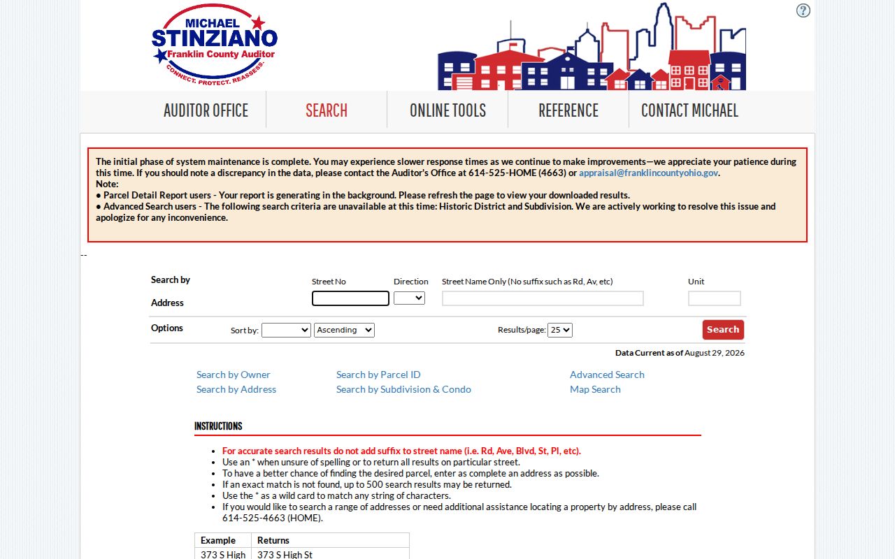
Use an individual property profile to verify a selected result before following it into any other record system. If the street spelling is uncertain, keep the wildcard result narrow enough to review one parcel at a time. The county’s address-search assistance route is 614-525-4663 when a broad search needs help.
Match Madison Township Streets to Parcels
A parcel profile distinguishes the physical site from the place where an owner receives correspondence. It can display parcel ID, map routing, tax district, township, City/Village, ZIP Code, owner, owner mailing or contact address, site address, legal description, transfer details, and property characteristics. That distinction matters in Madison Township because a mailing address is not proof that an owner lives at the site, and a site address is not a full roster of occupants.
The Auditor’s Parcel ID Search accepts all or part of a parcel ID without dashes. It is a useful fallback where a street number is uncertain or an address format has changed. The county says online data should be verified with the primary source, so record the parcel details needed to repeat the search rather than relying on a quick screen reading.
The parcel-ID search display is a useful bridge from an address-style question to a stable property identifier.
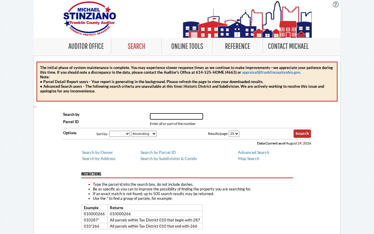
Once a matching parcel is selected, the profile separates its site and mailing fields and supplies the legal-description bridge for Recorder work.
The sample Madison Township parcel profile illustrates the field layout without republishing an individual’s data.
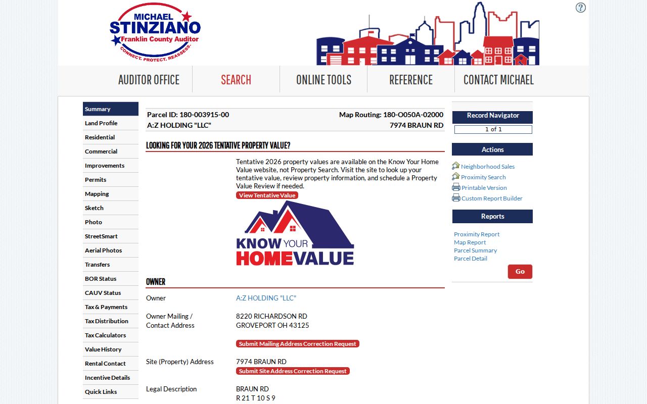
Read a result as a property record: the owner, mailing/contact address, and property address are separate facts that need separate treatment.
Madison Township Records Searchable by Street
No one Madison Township street directory source supplies every answer. The useful set is a chain of address-keyed records, each with a defined limit. The Auditor begins the parcel connection, the Parcel Viewer places that parcel on the map, and the Recorder supplies recorded-document roles. A permit or code inquiry must first be routed to the authority holding the site’s records.
| Address record | Keeper | What it can support | Access and limit |
|---|---|---|---|
| Property roll | Franklin County Auditor | Parcel, owner field, mailing versus site address, legal description, transfer, and property details | Public address, owner, and parcel searches; not proof of current occupancy. |
| Parcel map | Franklin County GIS | Parcel selection, mapped street segment, layers, imagery, and nearby selected parcels | Public viewer; map data is not household-presence data. |
| Recorded documents | Franklin County Recorder | Parties, date, document or book/page, OCR, legal fields, deeds, and plats | Cloud or legacy index and historical method; not a title opinion. |
| Permit, zoning, or code file | County or situs municipality | Project, inspection, or compliance records where releasable | Custody depends on jurisdiction; no universal historic online index is documented. |
| Individual voter confirmation | Franklin County Board of Elections | A carefully matched voter result for a known person | Required person-specific inputs; no browse-all-street mode. |
| Historic directory or census | Library, archive, or federal repository | Time-stamped household or address clue | Use after confirming locality and period; old labels may differ. |
A full named-street question remains different from a one-person verification. Where the purpose shifts to confirming one known individual across records, use the more focused workflow on the Madison Township resident lookup.
Trace Madison Township Street Deeds
Recorder Cloud Search is strongest when the parcel search has already supplied a transfer date, document party, subdivision, or legal description. Quick Search allows a term, recorded-date range, quick date filters, and a choice between Index Only and Index & Full Text (OCR). Index Only treats multiple words individually in indexed information. The OCR option searches multiple words as a phrase across document text. Advanced Search adds Party Names, Grantor, Grantee, document number, book/volume/page, document type, recorded date, and legal-description controls.
Use the role recorded in the document. A grantee is a party receiving an interest, and a grantor is a party transferring one. Neither label alone answers who lives on the property now. A tight date range around the Auditor transfer can reduce false matches, while a legal description links a deed to land when the common street address is absent.
- Parcel
- A county property unit identified by a parcel ID and map location.
- Situs address
- The physical property address shown on the profile, distinct from an owner mailing address.
- Plat
- A recorded map that lays out lots, streets, or subdivisions.
- Criss-cross directory
- A historical directory arranged by address, useful as a dated clue rather than a current-residency record.
For early work, the Recorder’s historical guide documents deed indexes from 1804 through 1913 and notes that some records were destroyed in the 1879 fire but most were reconstructed. The guide uses surname-prefix index pages and cited book/page references. That path is best for a historic property trail, not a shortcut around present-day privacy limits.
Note: Certified-copy pricing in the Recorder’s historic guide is $2.00 per page plus $1.00 per document, available in person, by mail, or electronically through its certified-copy route.
Madison Township Street Permit Custody
Street records change with the situs jurisdiction. Madison Township says it has no zoning or building department and does not issue permits. Franklin County Economic Development & Planning handles the unincorporated territory, while Groveport and Canal Winchester addresses must be taken to their city departments. The county building page adds that Groveport and Obetz issue zoning-compliance and building permits. Confirm the parcel’s City/Village, Township, and tax district before asking for a file.
The Franklin County Online Permit Center supports building, HVAC, and zoning applications, document uploads, payments, inspections, and results. It does not advertise a complete address-searchable historic permit database. For records not visible online, use the county building or planning contacts, a counter visit, or a narrow request under the Ohio Public Records Act, R.C. 149.43.
The county permit center is an application and inspection channel, not evidence that every historic project can be searched on the web.
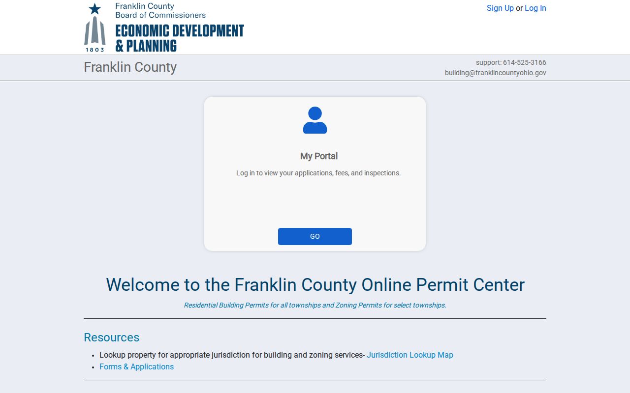
When an address falls in unincorporated territory, the county’s published path is the appropriate place to ask about a specific zoning, building, or inspection record.
The Franklin County Building information identifies the jurisdictional split and the counter route for address-level questions.
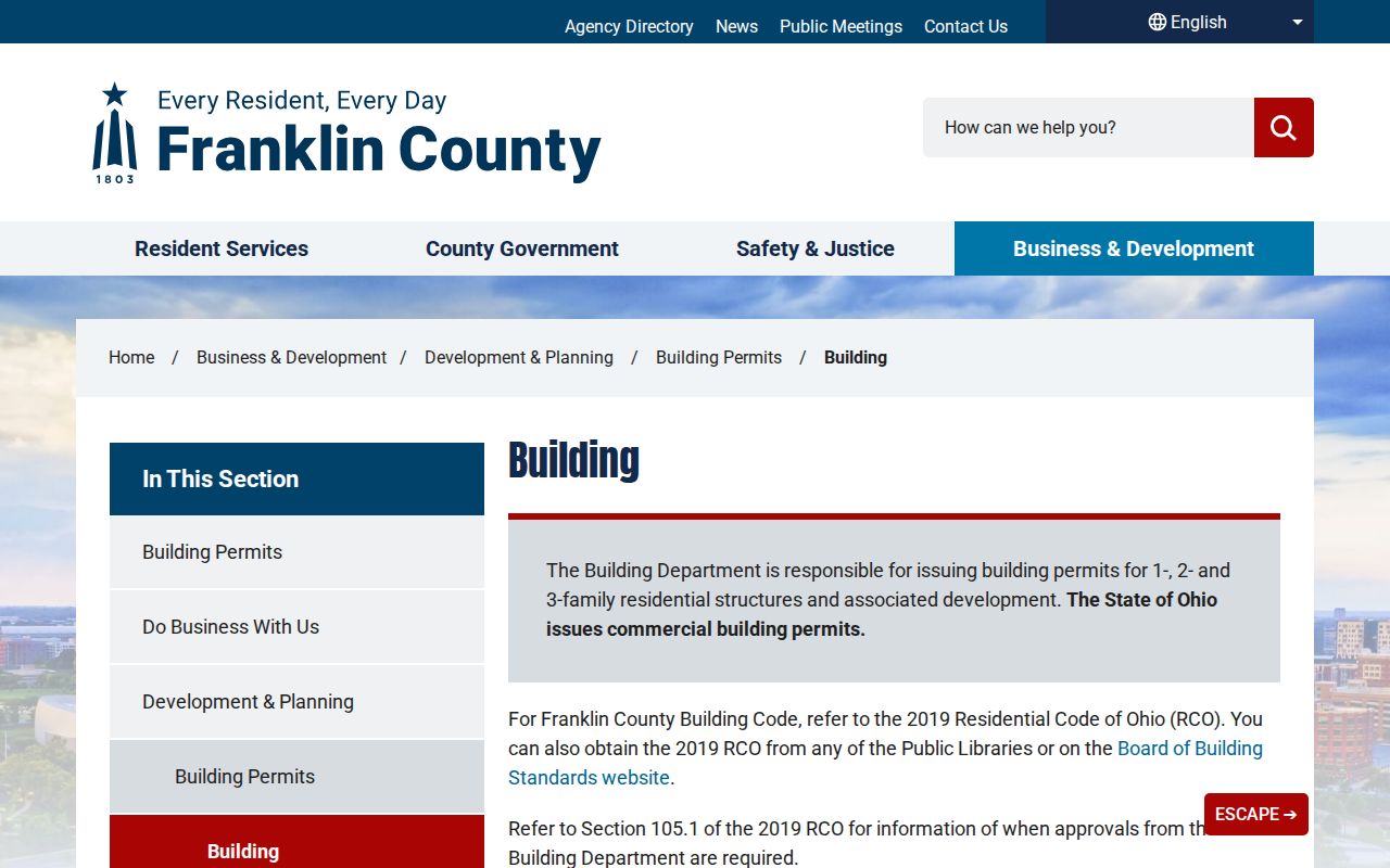
Published counter hours are Monday through Thursday, 9 a.m. to 1 p.m., and Friday, 8 a.m. to noon, with appointments preferred.
Madison Township Street Directory Boundaries
Postal city, municipal boundary, and township field are different search clues. A Madison Township Auditor sample uses the tax-district label MADISON TWP EXC CW GRVP OBTZ PICK, separating the unincorporated balance from Canal Winchester, Groveport, Obetz, and Pickerington-associated areas. Capture that information before sending a permit, code, or municipal-record request.
The township’s service geography reaches several communities, and older records may use a village, rural, farm, canal, depot, P.O., or R.F.D. description instead of a modern street format. No verified township-wide street-renumbering year was found in the inspected sources. When an older address fails, use the legal description, subdivision, plat, or Recorder book/page trail instead of assuming a renumbering date.
The Auditor displayed a 2026 maintenance notice and data-current date, with a warning that slow responses could continue. Retry an empty or delayed property search and verify it with the Auditor rather than treating a technical result as the absence of a parcel.
Madison Township Street Directory Limits
Ownership is not the same as a present household. Auditor and Recorder material documents assessed property and recorded transactions, while utility accounts, delivery records, motor-vehicle addresses, and private association membership are outside this public address-record workflow. The local voter form requires first name, last name, birth year, house number, and a bot check. It does not provide a street-wide roster or ballot choices.
Ohio also protects sensitive data. Public voter records exclude defined identifying and protected-participant information under R.C. 3503.13, and Safe at Home participants have address protections. Do not infer or seek protected residence details from nearby property records. Correct an online record through the office that maintains it when a qualifying error or redaction issue is found.
Lawful use. Madison Township street records support careful property, family-history, civic, and personal research. They never authorize monitoring, threatening, repeated unwanted contact, or trespass, which Ohio law addresses in R.C. 2903.211, R.C. 2917.21, and R.C. 2911.211.